Directional Drilling in Gillette, Wyoming
Directional drilling, MWD/LWD and well planning for horizontal programs across the Powder River Basin.
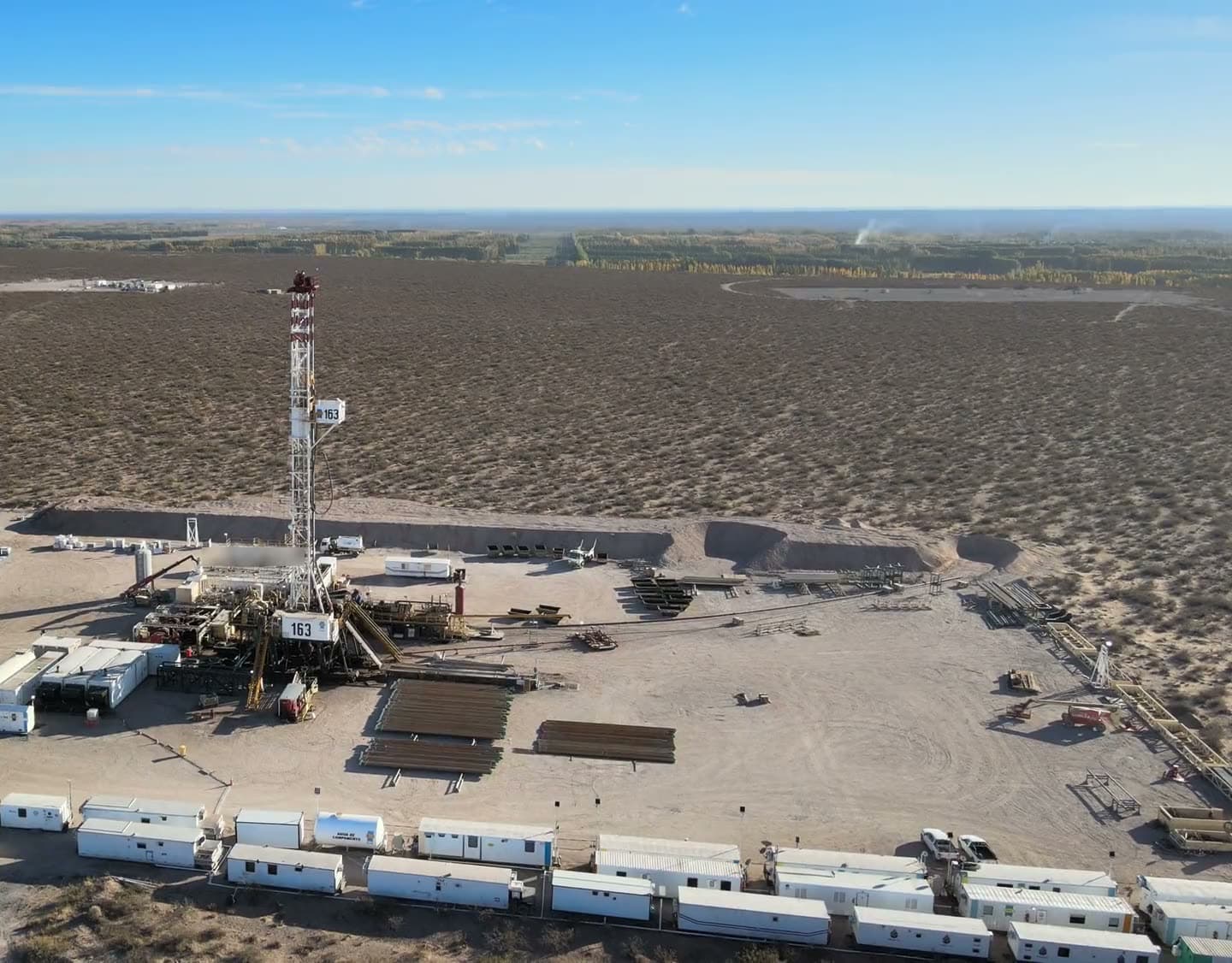
Geo Mag Technologies provides directional drilling services for operators working around Gillette, Wyoming. Campbell County is the center of the Powder River Basin, and Gillette is where much of the basin's drilling is staged. Geo Mag's documented Powder River Basin experience is one county south, in Converse County, where its company presentation lists two horizontal wells for Samson Resources; they are shown on this page.
Geo Mag supplies the mud motors, MWD tool and complete bottom hole assembly needed to drill a deviated well and provides well planning and technical consulting. It mobilizes to Wyoming from Broussard, Louisiana.
- Region
- Powder River Basin
- County
- Campbell County, Wyoming
- Coverage
- Available for projects anywhere in the United States
- Mobilizes from
- Broussard, Louisiana
- Availability
- 24 Hours
- Documented wells
- Listed below, from the company presentation
At a glance
Documented Powder River Basin field experience (Converse County)
Horizontal wells listed in the Geo Mag company presentation, with operator, location, average hole angle and measured depth.
These wells are documented in Converse County, south of Gillette, and are shown here as broader Powder River Basin experience. None of them is in Gillette or Campbell County. The Geo Mag company presentation lists them without dates.
| Well | Operator | Location | Avg. angle (deg) | Measured depth (ft) |
|---|---|---|---|---|
| BR Federal Resources | Samson Resources | Converse County, WY | 93.4 | 14,836 |
| DCR State #21-16H | Samson Resources | Converse County, WY | 96 | 14,825 |
SourceWells as listed in the Geo Mag company presentation. Dates are not stated.
Horizontal development in the Powder River Basin
The Powder River Basin has moved from a coalbed methane and conventional province to a horizontal oil basin in recent years. Operators target a stack of Cretaceous intervals including the Turner, Parkman, Teapot, Sussex, Shannon, Niobrara and Mowry, so the same pad can serve several landing zones at different depths.
Multiple targets on one pad make the well plan and the survey program the backbone of the program. Laterals here are long, and the basin's mix of federal, state and private minerals means the surface location is often fixed before the target is, which is where directional planning earns its keep.
SourceRegional geology and development patterns are general public information about the basin, not Geo Mag claims. Geo Mag statements and manufacturer figures are attributed on the Technology page.
Capabilities shown on Geo Mag's Wyoming wells
The Converse County wells Geo Mag lists were drilled with average hole angles of 93.4 and 96 degrees to measured depths of about 14,800 ft. Geo Mag supplies Bico and Tomahawk mud motors, RSS, Key Drill drilling systems and complete BHA packages, steered on surveys from company-owned positive-pulse MWD tools.
For a stacked-target program the wave propagation resistivity sub and gamma in the same string help land and hold each lateral, in water-based or oil-based mud. Polaris logs the data with WITSML delivery to the operator, so the well can be watched from Gillette, Casper or Denver.
Drilling systems: Bico and Tomahawk mud motors / RSS / Key Drill drilling systems / Complete bottom hole assembly (BHA) packages.
Full directional drilling serviceAll systems and specifications
Systems relevant to this region
Positive-pulse MWD tool
Directional, gamma and resistivity configurations
The MWD tool is the instrument that tells the directional driller where the bit is and where it is heading. Survey and tool-face data come up the mud column as pressure pulses, so the trajectory can be corrected while drilling instead of after a trip.
Wave propagation resistivity (WPR) sub
Geosteering, correlation and wireline replacement
Propagation resistivity reads the formation around the bit in real time, so a lateral can be steered to stay in the target zone and casing points can be picked without waiting on a wireline run.
Polaris RDS logging system
Gamma and directional data logging with remote monitoring
The logging system is where surveys, gamma and drilling parameters become the well record: plots, LAS files and reports the operator keeps, and a live feed the office can watch without being on location.
SourceSystem roles from the Technology page; Geo Mag statements and manufacturer specifications are attributed there.
Areas served around Gillette
Geo Mag is available for directional drilling projects across the Powder River Basin, including work staged from:
- Wright
- Moorcroft
- Buffalo
- Douglas
- Newcastle
- Sundance
- Johnson County
- Converse County
- Crook County
- Weston County
- Sheridan County
Nearby service areas
SourceCoverage statement from the Geo Mag questionnaire: available anywhere in the United States; travel distance is not a limiting factor. Places listed are areas Geo Mag is available to work in, not offices or completed projects.
Directional drilling questions for Gillette
Geo Mag's company presentation lists two horizontal wells for Samson Resources in Converse County, Wyoming, with average hole angle and measured depth. They are shown on this page and on the Field experience page. The presentation does not state dates and does not list wells in Campbell County.
Discuss a Gillette drilling project.
Call or text (337) 278-4607, 24 hours. Or send a message through the contact form.